
Eminent domain no longer on table for German Village
PROTECTED CONTENT
If you’re a current subscriber, log in below. If you would like to subscribe, please click the subscribe tab above.
Username and Password Help
Please enter your email and we will send you a password reset link.
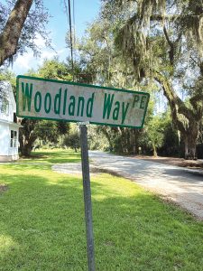
One of the private easement signs in German Village subdivision.
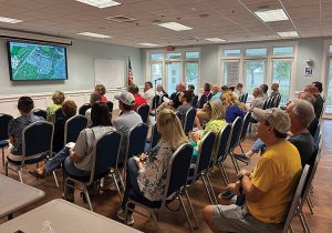
Wednesday, Sept. 23, 2026 county meeting with German Village
By Pamela Permar-Shierling
Residents of the area on St. Simons Island known as German Village were assured last night (Sept. 23) that eminent domain would not be used by Glynn County to take any private property for opening rights-of-way.
The assurances came during a public meeting held with residents by Glynn County District 2 Commissioner Bob Duncan and Assistant County Manager Danny Smith.
The location of streets and lot lines within the two subdivisions has been a point of confusion and contention for decades. Prior attempts by Glynn County to unravel the location of property lines in the neighborhood were abandoned.
The Wednesday meeting marked ten months since the County’s first meeting with German Village residents last November on plans to delineate and open rights-of-way in the neighborhood to accommodate new development.
German Village, as it is commonly referred to, actually consists of two separate subdivisions.
There is the Village Bluff Subdivision located on Village Bluff Creek to the east and platted in 1922.
Village Bluff’s northern boundary is Club Drive, existing only on paper, and the southern boundary is Creek Drive, another paper street that runs along the fence line of the St. Simons Land Trust property that was once Musgrove Plantation.
The 1938 plat for the neighboring Breedlove Subdivision, filed 16 years after the creation of Village Bluff, was for an undeveloped tract between Village Bluff Subdivision and Couper Road (now Lawrence Road) to the west.
The smaller Breedlove Subdivision’s northern boundary is Club Drive, which only exists on paper, and its southern boundary is Village Drive.
Oak Drive is part of the original Village Bluff Subdivision that forms the east/west boundary line between Village Bluff and the newer Breedlove Subdivision created 16 years later.
Although the smaller Breedlove subdivision is often lumped in discussions as part of the larger and older Village Bluff Subdivision, they are two distinct and separate subdivisions created by different developers under different ownership.
This distinction was also lost at the Wednesday meeting, where County staff and officials continued to lump the entire project area under Village Bluff.
In March 2023, attorney Steven Blackerby of the law firm Brown, Readdick, Bumgartner, Carter, Strickland, & Watkins, LLP, provided a three-page letter opinion to a Village Bluff resident “on the “Breedlove addition” and its relationship (or lack thereof) with the Village Bluff Subdivision.”
Note: Gov. Brian Kemp appointed Judge Blackerby to the Brunswick Judicial Circuit Superior Court in February.
Blackerby states in the letter that “it does not appear that Harry Breedlove had any power to add property to the Village Bluff Subdivision.”
He noted the name on the 1938 plat calls it “Harry Breedlove’s Addition to Village Bluff Subdivision.” He added, “the use of the name “Breedlove Addition” has the potential to cause confusion because it suggests the property shown on the 1938 plat is essentially an “addition” to the Village Bluff Subdivision.”
Blackerby observed that although Breedlove may have “thought” he was adding property to the Village Bluff Subdivision, “it does not appear that he (Breedlove) had any power to add property to the Village Bluff subdivision.”
This failure was “because he did not own the property composing Village Bluff Subdivision.”
Blackerby stated that under the “common grantor rule” a “developer is capable of filing a plat giving lot owners easement rights over subdivision roads, common areas and other easements only if the developer owns the property comprising those subdivision roads.”
He continued, “Under this rule, because he did not own the property composing the Village Bluff Subdivision, Breedlove could not file a plat purporting to add to that subdivision.”
He concluded, “the reality is the property shown on the 1938 plat is not actually part of the Village Bluff Subdivision… therefore the Breedlove Subdivision should be treated as an entirely separate subdivision from the Village Bluff Subdivision.”
Blackerby also noted that Breedlove did not have ownership of 38 lots in his own subdivision when he filed the plat.
Under the same common grantor rule previously cited, “a developer can only file a plat affecting rights with respect to property actually owned by that developer.”
Finally, Blackerby states he does not believe that the owners of lots in the Breedlove Addition possess any easement rights to use the Village Bluff common areas.
There is no reference to dedication of roads to Glynn County on the 1922 Village Bluff Subdivision plat.
The 1938 plat for the Breedlove Subdivision has a handwritten, one paragraph statement in the corner that states, “I the undersigned owner of the tract shown in this plat which is located on St. Simons Island Glynn County Georgia do hereby dedicate to the use of the public forever all roads, streets, drives, parks and a three-foot easement on rear of all lots for public utility uses.”
The 1938 reference on the Breedlove plat generally cited by County staff dedicates the use, not the ownership, of the roads to the public, not the county, forever. The use includes roads, parks, streets, and drives and a three-foot easement at the rear of all lots for public utilities.
The statement by the owner only applies to the Breedlove Subdivision.
Except for Village Drive and Virginia Drive, all the side streets in the Village Bluff subdivision have decades-old county-installed Private Easement (PE) signs, indicating they are privately owned.
During the meeting Lisa Norton questioned what document gives the county the legal ownership of the roads in German Village, County Attorney Aaron Mumford said it was a combination of things.
Mumford named the original subdivision plat (but did not specify which plat); case law (no case law was referenced) and the fact that the county has maintained two of the roads (Village and Virginia) for decades.
These two streets were paved in the early 1990s, but not built nor maintained to county standards.
He said, “Once we go in and pave one road, we accept all the roads.”
There was no explanation of why the County claims full ownership of the rights-of-way in German Village and not just control of an easement as in other older subdivisions.
The County ordinance states that in pre-1976 subdivisions, the adjacent landowners on either side of an easement own the land to the centerline of the street or road. The county in these cases does not hold title to the road, but has only an easement over the land.
At more than 100 years old, Village Bluff is among the oldest subdivisions in Glynn County. Glynn County did not adopt its first subdivision ordinance until August 5, 1976.
Mumford said the county wanted to get the actual metes and bounds of the ROWs set so “we would know and you all would know where everything sits.”
Mumford was asked if the county would file a new plat and he said that was up to the Commission. “That is why we are introducing this (exhibit) tonight so that everyone is aware of it.”
Then he said he didn’t know if the Commission actually had to adopt a new plat because everyone had their own deeds.
“If this affects your property in a way that you need answers, we will address those one by one,” Mumford said.
Mumford pointed out that there was more land on paper than actual land on the ground. “This will correct more issues that it creates,” he said.
Norton made another statement regarding the exhibit drawing that the county was sharing during the meeting. “This rendition (referring to the exhibit provided for the meeting) has been referenced as a survey yet it doesn’t meet the legal terms of a survey. Could you state who prepared this and is this a final product?”
The BOC approved a purchase order and agreement on October 16, 2025, in its consent agenda to award a contract to Shupe Surveying for work in German Village.
The award was made as a professional services exemption to the company not to exceed $32,000.
The proposal letter from Shupe, dated September 29, 2025, and signed by County Surveyor Teeple Hill, states the company would produce an “exhibit” that “locates sufficient property corners along the rights-of- way to depict the apparent rights-of- way.”
The Shupe letter referenced work in the Village Bluff subdivision, but not in Breedlove. It also emphasized twice that “a boundary survey of Village Bluff will not be included as part of this project.”
The final renderings by Shupe Surveying and displayed at the September 23 meeting were titled “Village Bluff Subdivision Rights-of- Way Exhibit.” The drawings were not stamped or certified as surveys.
County staff and the Shupe rendering handout listed the basis of the new renderings as the 1922 Village Bluff Subdivision plat. It did not reference the 1938 plat for the Breedlove Subdivision.
The 1922 Village Bluff Subdivision plat used as the starting point by the County also reveals a clue to the land shortfall of approximately 120 feet within the subdivision that was mentioned by the county attorney. Unopened Creek Drive that forms the southern boundary of Village Bluff is shown as running along Boat House Creek.
This creekside boundary shown in the 1922 Village Bluff plat would shift the Subdivision’s southern boundary with Musgrove Plantation approximately 120 feet south of where it is depicted today.
The Musgrove estate was purchased and created by combining eight parcels by R. J. Reynolds heir Nancy Susan Reynolds (Bagley) in 1938.
Another comment about county ownership of the roads came from Gloria Burns. It was pointed out that during the St. Simons Land Trust (SSLT) conflict with German Village residents about using Village Drive to access the waterfront park and boat launch of Guale Preserve (SSLT property), GaDNR had offered an alternate route using an earlier turnoff at Oak Drive, south of Village Drive to access SSLT’s property using Creek Drive.
The route would have redirected outside park and launch traffic away from most of the residential area and improve safety for residents and visitors. However, at that time the county said they could not prove its ownership of the unopened Oak and Creek Drives.
“But if you are now saying that the county owns all the roads just by maintaining one road, can SSLT traffic be routed down Oak Road and Creek Drive?” she asked.
Smith said that was not something the county was discussing with the Land Trust but, “We can,” he said. “In my opinion that would be a Land Trust decision if they wanted to relocate their gate.”
Oak Drive, part of the original 1922 plat for Village Bluff Subdivision, is shown as a 50-foot right-of-way both north and south of its intersection with Village Drive.
On April 16, 2006, the Glynn County Board of Commissioners (BOC) voted to exempt the streets in the Village Bluff Subdivision (aka German Village) from the 50-foot right-of-way requirement of the subdivision regulations.
County attorney Gary Moore presented a memorandum entitled “German Village Protocol” that described the problems with streets in the German Village neighborhood. He noted that German Village was actually made up of two distinct subdivisions – the Village Bluff subdivision platted in 1922 and the Breedlove subdivision that was created in 1938.
The Village Bluff subdivision side streets had been platted with a 30-foot right-of-way. Moore recommended the substandard streets be allowed if they included a 20-foot paved roadbed. Utilities, such as water and sewer, would also have to fit within the reduced right-of-way.
Moore stated that enlarging the rights-of-way beyond 30 feet “as a practical matter, “it is impossible to obtain additional right-of-way without expensive condemnation.” This would require the County’s use of eminent domain to take private property.
In their vote, the BOC and attorney clarified that the decision for the Village Bluff subdivision also applied to all pre-1976 subdivisions countywide with substandard streets. Glynn County did not adopt its first subdivision ordinance until August 5, 1976.
However, the 1938 plat for the adjacent but separate Breedlove subdivision shows a 70-foot right- of-way for the portion of Oak Drive north of Village Drive on its eastern boundary with Village Bluff.
With all other adjacent side streets platted with a 30-foot right-of-way, County staff did not explain why the Breedlove width was used in this instance or why Oak Drive would require a 70-foot right-of-way that is more than twice the width of the other side streets.
One of the two homes on the depicted drawings is located within the proposed 70-foot Oak Drive right-of- way.
Burns also asked about eminent domain. “I see on the rendering two residential structures located in two of the paper streets that haven’t been opened yet. One at Cross Drive and one on Oak. What I am hearing you say is that there is no fear of eminent domain on either of those structures.” Smith replied, “Absolutely zero fear of eminent domain. Not going to happen.”
Note: Both homes depicted in the drawings as being in the right-of-way were permitted by Glynn County; one in 1973 and one in 1992.
However, condemnation of homes had not been ruled out at the November 2025 meeting with residents just ten months earlier. When asked, County Manager Bill Fallon said, “Some hard decisions would have to be made.”
At that November meeting, residents had also requested that the survey work start at the northern border that was well-documented and had established landmarks.
Instead, the County chose to start the new project using the southern border of Village Bluff and the western border of Breedlove. The western border relies on the 1938 Breedlove Subdivision plat that conflicts in several locations with the original 1922 Village Bluff Subdivision plat.
The new rendering does not fully align with the 1938 Breedlove plat.
The Shupe exhibit shows multiple overlapping lots in the Breedlove Subdivision along with widely varying rights-of-way and unaligned streets such as Gardner, DuBignon, Krauss, Harwell, and Club Drive.
At least one lot that is shown on the County GIS appears to be missing in the new drawing for the Breedlove subdivision.
Although not mentioned by staff, there have been multiple plats of both subdivisions.
A resident asked how the County would handle legally permitted homes that may no longer meet required setbacks under the proposed rights-of-way.
County officials responded that previously conforming homes could now become nonconforming as the newly drawn rights-of-way shifted into existing approved setbacks when their homes were constructed.
Commissioner Walter Rafolski (At Large Post 2) stated that the county would cover the variance costs for homeowners who find their homes nonconforming under the new renderings.
Commissioner Duncan advised residents to call the county if they needed a variance.
However, the drawings presented did not show structures that would have reduced setbacks. It was not addressed how property owners would know if they were meeting new setback lines with the limited information on the drawings.
Commissioner Duncan said most of the roads have not been adequately opened and the rights-of-way (ROW) need to be open to provide needed emergency services.
“This is why the survey (sic) was done and staff has identified all potential conflicts and has a solution for each one,” he said. “Our intent is to open for emergency services.”
Smith said, “I was assigned this project to delineate and define the rights-of-way. The survey (sic) found all the block corners and Club Drive is gone.”
Smith explained during the November 2025 meeting with German Village residents that the reason for the survey was to identify and delineate the county’s roads in German Village and to clear the rights-of-way and improve the streets for new development.
A recent surge in builder interest also prompted the push to clear unopened streets in the two subdivisions.
The October 2025 staff report to the BOC on the project states “a recent increase in home construction has led to concerns over allowing residential home construction along these unimproved ROW.”
Active developers and builders in the subdivisions include Thomas Stewart and Harwell Holdings LLC in the western portion of Breedlove Subdivision and SG&MBG LLC in the southern portion of Village Bluff.
The six new home lots developed by Stewart are concentrated along Village and DuBignon Drives in the Breedlove Subdivision.
The Harwell Holdings LLC tract was approved by the county as an expedited subdivision in June 2025 as a 2.28-acre development of 15 lots. It was held by Blue Ocean Prospects, LLC tract at that time and sold in February 2026 to Harwell. Blue Ocean Prospects, LLC is owned by James and Jonathan Roberts.
Construction plans submitted for the Harwell tract by Roberts Civil Engineering in June 2025 included unimproved portions of Harwell Drive, Krauss Drive, and an unopened portion of Gardner Drive within Breedlove.
The Harwell tract is zoned R-6. It was last purchased for $1.03 million in February 2026. The tract is now on the market for $1.95 million as of August 2026, under a combined listing as “15 platted lots ready for development.”
Glynn County initiated and approved its own abandonment request in May 2026 for the small portion of Club Drive between Lawrence Road and Gardner Road, adjacent to the Harwell tract in the Breedlove subdivision.
The report recommendation noted the “Property has been in use as private property for decades.”
There was no mention of the abandonment of the remainder of Club Drive in the report.
SG&MBG LLC is owned by Marshall Bruce Garrett and Steven Graham. Their holdings total ten parcels on the south side of Village Bluff with frontage on the unopened portions of Franklin Lane and Woodland Way.
According to both Danny Smith and Bob Duncan, these areas to the south and west have been prioritized for the first round of county-funded road improvements.
Improvements to accommodate new housing will include the clearing of unopened rights-of-way and building of 20- to 22-foot-wide gravel roadbeds, along with drainage.
Duncan said that encroachments will be discussed with individual property owners. “No one will be hurt,” he said. “Some rights-of-ways may not need to be opened. We haven’t determined that yet. We should be able to save the larger trees in the ROW if they survive the grading,” he said.
“There won’t be a community discussion about the structures in the way. We will talk to the individual property owners,” Duncan said. “If you know you have a conflict, reach out to Danny’s (Smith) staff.”
“This project is intended to provide you with all the county services you deserve,” he continued.
Smith said road clearing and construction is expected to start as early as December in the undeveloped portions of south Village Bluff and west Breedlove subdivisions.
There was no comprehensive storm-water improvement plan shown. Smith said stormwater improvements would be handled as the new roads are opened and constructed.

Excellent journalism, research, and fact giving information! Well done!